In architecture, engineering, and heritage conservation, every successful project rests on the reliability of its initial site data. For decades, the industry standard for measured building surveys relied on handheld laser distos, tape measures, and hours of manual sketching on-site. While effective for straightforward rectilinear rooms, traditional surveying methods quickly show their limitations when applied to complex historic structures, multi-storey commercial conversions, or heavily serviced hospitality venues.
Twelve months ago, Awesome Proportions Ltd made a major investment in our technical workflow by bringing the Leica RTC360 3D LiDAR laser scanner in-house.
Over the past year, integrating survey-grade reality capture into our daily practice hasn’t just improved our architectural drawings—it has fundamentally changed how we approach complex buildings. Furthermore, because the hardware is ultra-portable, it has enabled us to offer standalone, high-precision 3D point cloud and measured survey services to fellow architects, developers, and engineers across the UK.
Here is a look back at our first year operating the Leica RTC360, the tangible improvements in speed and accuracy, and how it performed on three very different projects across Hull and East Yorkshire.
Why We Invested in Survey-Grade LiDAR Technology
When working on complicated refurbishments or heritage restorations, discovering an unexpected structural deviation during the construction phase is expensive. A wall that bows out by 75mm, a sagging timber floor, or an undocumented change in ceiling height between rooms can invalidate prefabricated joinery, disrupt structural steel calculations, and delay building control sign-off.
We chose the Leica RTC360 specifically because it bridges the gap between rapid data capture and rigorous engineering precision. Rather than relying on lower-grade mobile scanners that sacrifice range and tolerance for convenience, the RTC360 delivers true survey-grade data directly into our Leica Cyclone Register 360, Autodesk Revit, and AutoCAD environments.
1. Uncompromising Millimetre Accuracy
The Leica RTC360 captures up to 2 million points per second, achieving a 3D point accuracy of 1.9mm at 10 metres. Instead of taking ten discrete measurements in a room and assuming the walls between them are straight and plumb, we capture millions of individual spatial coordinates. Every mortar joint, timber deflection, window reveal, and overhead pipe is recorded in true 3D space. When we return to the studio, we aren’t guessing how a building fits together; we have a digital twin sitting on our workstations.
2. Radical Speed on Complex Sites
Before adopting LiDAR, surveying a complex multi-room or multi-storey building could require days of intrusive site visits—and often an inevitable return trip to verify an elusive dimension.
The RTC360 completes a full-dome, high-resolution 3D scan alongside a calibrated 360-degree HDR spherical image in under two minutes per setup. Crucially, the scanner features a Visual Inertial System (VIS). Using integrated video cameras and an inertial measurement unit, the scanner tracks its own movement in real time from room to room. By the time we walk from one setup location to the next, the scanner already knows where it is in relation to the previous scan, automatically aligning and registering the point cloud on-site without the need to place physical targets on walls.
3. True Portability for Nationwide Scanning Services
High-precision laser scanners used to be bulky, fragile instruments requiring heavy transport cases and multi-person crews. Weighing just over 5.3kg with a compact footprint and a collapsible carbon-fibre tripod, the Leica RTC360 packs neatly into a specialized backpack.
This agility means two things for our practice:
-
Access to Tight Spaces: We can easily carry the scanner up vertical loft ladders, into cramped historic roof voids, down narrow cellar stairs, and across uneven scaffolding.
-
Nationwide Deployment: Because the entire setup can be carried by a single operator on a train or stowed easily in the boot of a car, we are no longer geographically restricted. Alongside our core architectural work in East Yorkshire, we now deploy across the country to capture and deliver registered point clouds (
E57,RCP,LAS) and 2D/3D CAD deliverables for external practices and commercial clients.
Real-World Impact: Three Projects from Our First Year
The true test of any architectural technology is how it performs in the field. Over the past 12 months, the Leica RTC360 has proven indispensable across a wide spectrum of building typologies.
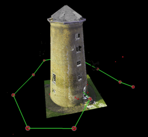
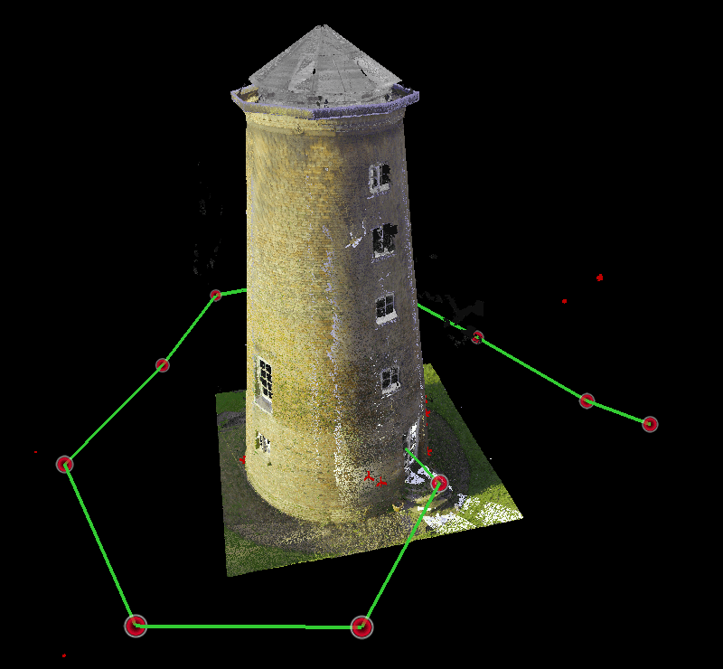
1. Heritage Precision: Grade II Listed Windmill, Burton Pidsea
Surveying historic and listed buildings presents an obvious geometrical challenge: there isn’t a single right angle in the building.
When tasked with surveying a Grade II listed windmill in Burton Pidsea, East Yorkshire, traditional tape-and-disto methods would have required days of complex triangulation, and the resulting drawings would still have been an approximation. Windmills are tapering, cylindrical masonry structures that have settled, shifted, and weathered over centuries.
Using the Leica RTC360, we captured the entire internal and external envelope rapidly and non-invasively.
-
Zero Physical Contact: When working with delicate historic fabric, Conservation Officers rightly scrutinize any invasive work. Laser scanning is entirely contactless, capturing high-resolution structural data from ground level without needing to fix targets to historic brickwork.
-
Capturing True Geometry: The resulting point cloud mapped the exact taper of the circular walls, the pitch and twist of historic timber beams, and the precise condition of the masonry.
-
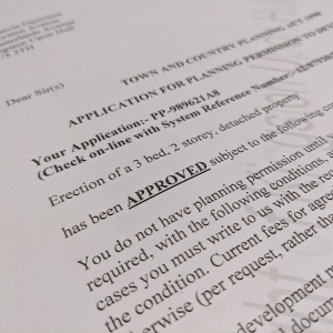
Planning & Heritage Compliance: When preparing Listed Building Consent applications and Heritage Statements, having millimetre-accurate sections and elevations gives local authority conservation officers total confidence that proposed interventions respect the existing structure.
2. Commercial Speed: Change of Use to Low-Rise Apartments on Witham, Hull
Converting existing commercial or underutilized urban properties into residential accommodation is a cornerstone of modern regeneration, but these projects always operate under tight commercial timelines and strict regulatory frameworks.
On a recent Change of Use application for a low-rise apartment development on Witham in Hull, speed and spatial coordination were paramount. Multi-unit residential conversions require a precise understanding of floor-to-ceiling heights, structural column grids, party wall thicknesses, and window alignments across every storey to ensure compliance with Building Regulations (particularly Approved Document B for fire safety, Approved Document E for acoustics, and national space standards).
With the RTC360, we scanned the entire building in a fraction of the time a manual survey would have demanded.
-
Eliminating “Dead Space” Errors: In multi-unit layouts, a cumulative measurement error of just 50mm across a floorplate can be the difference between a compliant hallway width and a failed building control inspection. The registered point cloud gave us an exact 3D slice through every floor level simultaneously.
-
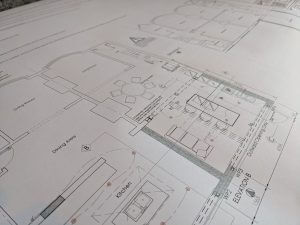
Rapid Scan-to-BIM Workflow: Importing the registered scan data directly into Autodesk Revit allowed us to model the existing structure with complete certainty, test apartment layouts rapidly, and submit a robust, rock-solid planning package without disrupting ongoing site operations.
3. Live Hospitality Venues: Modifications to Art House on Princes Avenue, Hull
Hospitality and commercial leisure venues present a completely different surveying headache: they are busy, cluttered, dimly lit, and cannot afford to close their doors during trading hours for a drawn-out architectural survey.
When brought in to design modifications to Art House, a popular bar on Princes Avenue in Hull, we needed comprehensive spatial data of a lived-in, architecturally eclectic environment filled with fixed seating, bar equipment, decorative fixtures, and complex M&E runs.
-
Working Around Operational Hours: Because the RTC360 captures a high-resolution scan in under two minutes, we completed the entire site capture in a narrow morning window before staff and patrons arrived—causing zero disruption to the business’s revenue.
-
High Dynamic Range (HDR) Imaging in Low Light: Bars and evening venues often have moody, high-contrast lighting where bright street-facing windows meet dark internal corners. The RTC360’s 5-bracket HDR imaging system automatically balances exposure, producing crystal-clear, colourised 3D point clouds and panoramic walkthroughs even in challenging lighting conditions.
-
Virtual Site Visits: When designing bar modifications, being able to open the spherical imagery and point cloud in the office meant we could check the exact height of an extraction duct, verify the clearance behind a bar counter, or inspect ceiling bulkheads without driving back to Princes Avenue.
Traditional Measured Surveys vs. Leica RTC360 LiDAR
For clients, contractors, and fellow design professionals weighing up the value of a 3D laser scan against a conventional manual survey, the practical differences across a project lifecycle are substantial:
| Feature / Project Phase | Traditional Manual Survey (Disto & Tape) | Leica RTC360 3D LiDAR Survey |
| Measurement Density | Dozens of discrete point-to-point dimensions | Up to 2,000,000 points per second (full 3D surface) |
| Dimensional Accuracy | Prone to human reading error & “square room” assumptions | Survey-grade 1.9mm 3D point accuracy at 10m |
| Time on Site | Full days; often requires return visits for missed details | Hours; complete spatial capture in a single visit |
| Irregular & Heritage Geometry | Extremely difficult to measure curved, leaning, or vaulted spaces | Effortlessly captures complex arches, tapers, and timber trusses |
| Visual Record | Separate handheld digital photos | Integrated 360° HDR spherical photography locked to 3D data |
| CAD & BIM Deliverables | Manual 2D drafting from paper sketches | Direct Scan-to-BIM (Revit) and 2D CAD extraction (AutoCAD) |
Frequently Asked Questions About 3D Laser Scanning
What deliverables do you provide from a Leica RTC360 survey?
Whether we are acting as the lead RIBA Chartered Architects on your project or providing a standalone measured survey for your design team, we tailor the output to your software environment. We supply fully registered, clean point cloud files in industry-standard formats (E57, Autodesk Recap .RCP/.RCS, LAS, and PTS), alongside navigable 360° TruView/panoramic image links, 2D AutoCAD plans, sections, and elevations (.DWG/.PDF), or full 3D Autodesk Revit (.RVT) models.
Does laser scanning damage fragile or listed buildings?
Not at all. The Leica RTC360 uses a Class 1 eye-safe, invisible 1550nm laser beam. It is 100% non-contact and non-invasive, making it the gold standard for Grade I and Grade II listed buildings, scheduled monuments, and delicate interiors where physical access or fixing survey targets is prohibited.
Can you travel outside of Hull and East Yorkshire for scanning projects?
Yes. Thanks to the compact, backpack-portable design of the RTC360, we provide rapid-response 3D LiDAR scanning and measured building surveys across Yorkshire, Lincolnshire, and nationwide across the UK.
Need a Measured Building Survey or Architectural Support?
Looking back on our first year with the Leica RTC360, the scanner has paid for itself many times over in eliminated site revisits, smoother contractor coordination, and faster planning approvals. Whether we are sensitively restoring a listed structure in the East Riding countryside, converting commercial floorspace in Hull city centre, or reconfiguring a vibrant hospitality venue, starting with millimetre-perfect reality capture removes the guesswork from construction.
If you are a property developer, homeowner, contractor, or an architectural practice looking for reliable 3D point cloud scanning, measured building surveys, or full RIBA Chartered architectural services, get in touch with Awesome Proportions Ltd to discuss your next project.